Apple’s troubled Maps app could be dangerous in the wrong circumstances, Australian police have warned, after rescuing several people who were directed into the outback by mistake.
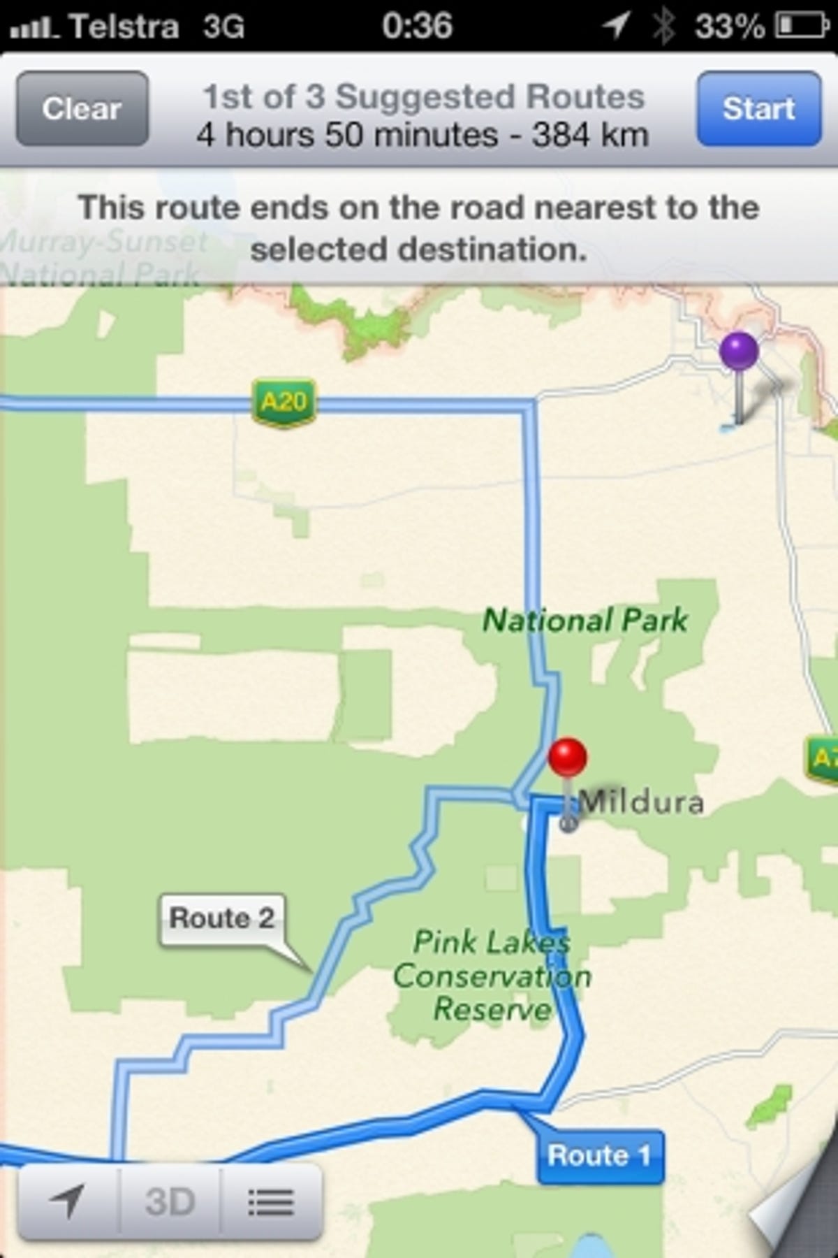
Cops in Victoria have had to fetch tourists from the huge Murray Sunset National Park, after their iPhones sent them more than 40 miles out of their way. Apple Maps plotted the entire town of Mildura in the wrong place.
“Police are extremely concerned as there is no water supply within the Park and temperatures can reach as high as 46 degrees, making this a potentially life threatening issue,” said Acting Senior Sergeant Sharon Darcy in a statement.
“Some of the motorists located by police have been stranded for up to 24 hours without food or water and have walked long distances through dangerous terrain to get phone reception.”


Apple launched its own Maps app with iOS 6 earlier this year, replacing Google’s mapping service. It was immediately clear that Apple’s effort wasn’t up to scratch, with users around the world spotting egregious errors. In the UK, Luton was plotted in Devon, and Heathrow Airport was located in Hyde Park, among many other howlers.
Over-reliance on sat-navs has led to serious problems in recent years, especially in remote areas where maps are not updated as often. NPR reported last year on tourists lost in California’s Death Valley due to out of date GPS maps, while in 2010 an ambulance crew in Leeds had difficulty finding an accident site because they were given a grid reference and not a postcode.
Apple boss Tim Cook was forced to apologise for the poor state of Maps, with heads rolling and competitors suggested as alternatives. Google is reportedly working on a new Google Maps app you’ll be able to download separately for iOS 6, but doesn’t seem to be in any hurry to do Apple the favour.
Has Apple Maps led you astray? Is it too easy to rely blindly on technology and miss clues around you? Explore the comments below, or find your way to our Facebook page.
Image credit: Victoria Police News


